-Jim Bell
This is the only Perseverance report LPI so far. It's a year old when I write this. Some things are no longer relevant, for example it was announced this week that Percy will hold it's samples and deliver them to a MAV alone.
So lets get down to it.
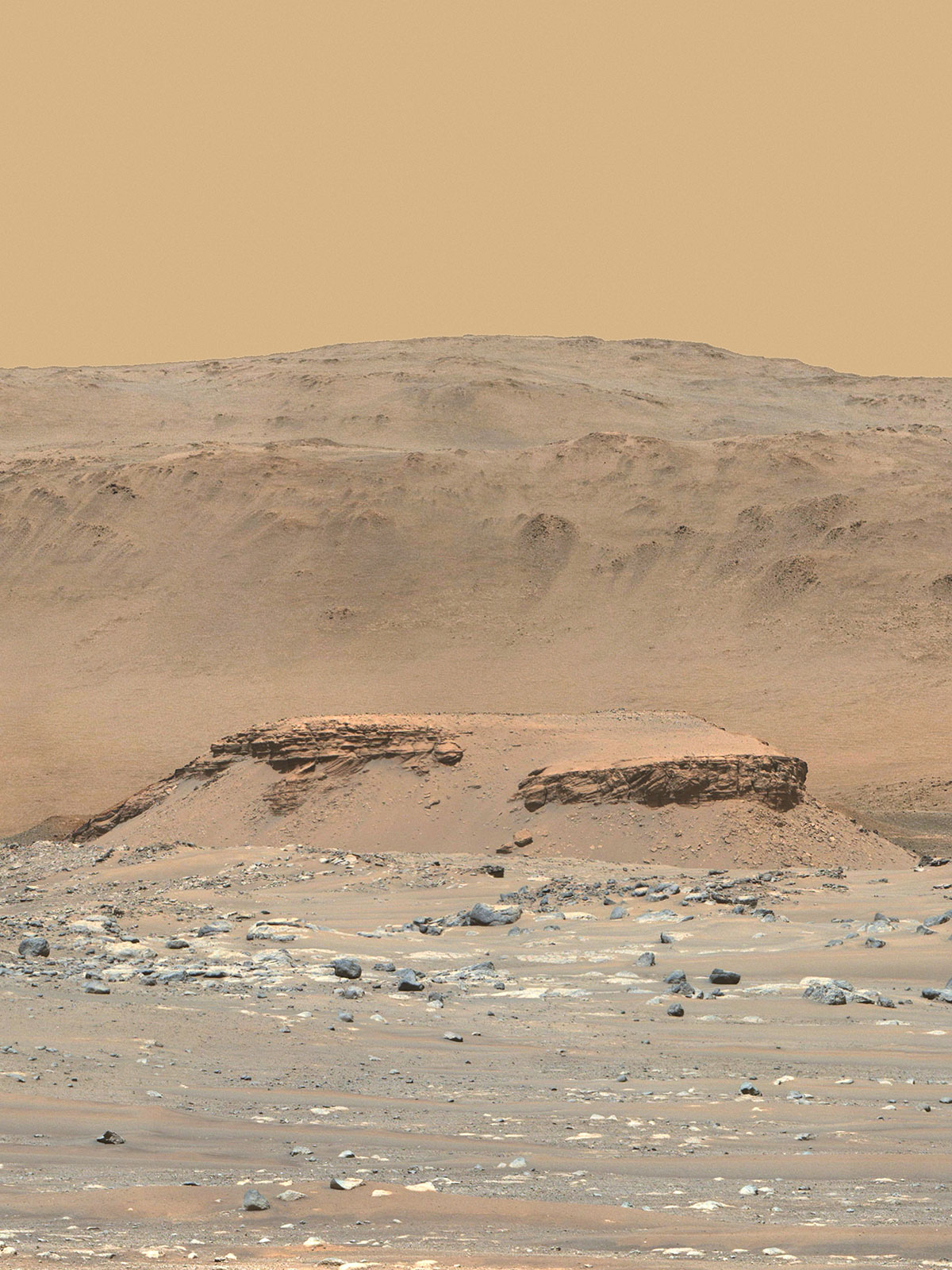
See this? It's named Kodiak. It was imaged Apr 2021, and this LPI came out May 2021. So I was nervous as heck watching this LPI, becasue that's cross-bedding in the middle of Kodiak and it's been driving me crazy since I first saw it.
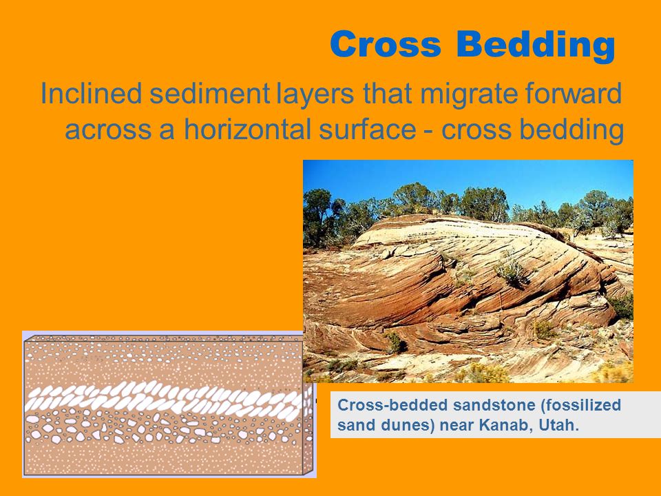
Cross-bedding is fossilized sand dunes. The image of Kodiak has cross-bedding, with flat layers above and below, in a delta, as a mesa. All of that tells a story, and the story is quite typical of real-Mars and flies hard in the face of fantasy-Mars.- There was a crater.
- The crater filled with a kilometre of silt.
- The flat layers on the bottom of Kodiak were lain first.
- The cross-bedding second.
- More flat layers third.
- Everything around it got eroded to leave the Kodiak mesa.
That means, that while the silt was getting laid down, there was a time, a big chunk of time, when the basin was completely dry. So dry, that sand dunes had time to spread, grow, get fossilized, and then covered by wet layers. Meaning that wet periods in Hesperian Mars were intermittent, not consistent. And wet can mean ice.
This is expected to a point, it's especially remarkable because it is very hard evidence. You still have to date the layers to make sure they really went in that order, geology can trick you if you don't double check. But Jezero is flagrantly Hesperian same as Gale crater is, so its never been at all plausible the delta was really from a rain-powered river. The question is if it's glacial, or eon-episodic due to something on the scale of Mars tilting or receiving an impact. Get it? That's real-Mars.
My fear was that this LPI came too soon and the team would sit on such a detail without comment till they could all push a paper through peer-review.
- At 11:40 Kodiak is first mentioned.
- 38:40 is a mind-twisting slide ambiguously showing what may be tilted strata, probably the delta-slope, but could be something else.
- At 40:40 he finally gets around to Kodiak, mentioning some debate about possible aeolian vs fluvio lacustrine and delteak structures. I believe they can settle all that by comparing grain sizes of the strata.
And that's it. The rest of the LPI from that time is great too, but the Kodiak stuff is what's compelling me personally. There is much in that 1-6 I wrote above that is still debatable, and I have not heard any good update since. There's some stuff about Ingenuity and the route planning they have been using in the rest of the vid.


No comments:
Post a Comment